Teotihuacan Map: Layout of the Avenue of the Dead & Main Structures
Quick answer
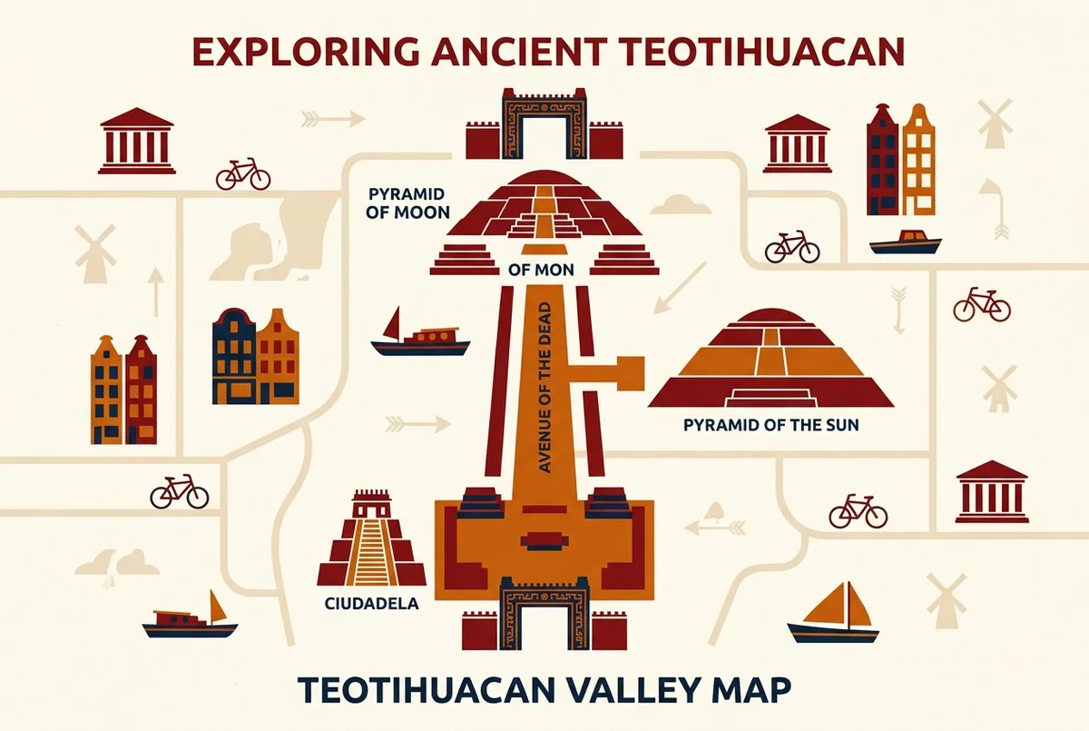
The **Teotihuacan map layout** centers on the roughly two kilometer Avenue of the Dead, running from the Ciudadela and Temple of the Feathered Serpent in the south, past the Pyramid of the Sun at the midpoint, up to the Pyramid of the Moon at the northern end.
Teotihuacan map layout, in short: everything runs off the Avenue of the Dead, a roughly two kilometer ceremonial road connecting the Ciudadela in the south to the Pyramid of the Moon in the north, with the Pyramid of the Sun sitting partway along the route. This guide walks through where each major structure sits, which entrance gates connect to which section, and how to plan a walking route that does not double back on itself.
What Is the Overall Shape of the Teotihuacan Site?
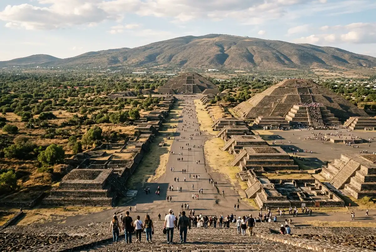
Teotihuacan’s ceremonial core follows a long, straight axis, the Avenue of the Dead, running roughly north to south for about two kilometers. Every major structure sits directly on or just off this avenue, which makes the teotihuacan site map easier to understand than it first appears: orient yourself to the avenue, and the rest of the layout falls into place.
Where Does the Avenue of the Dead Start and End?
The Avenue of the Dead begins at the Ciudadela complex near the site’s southern entrances and runs north to the Plaza of the Moon at the base of the Pyramid of the Moon. Along the way it passes dozens of smaller platform mounds, residential compounds, and the Pyramid of the Sun roughly at its midpoint.
Where Is the Pyramid of the Sun on the Map?
The Pyramid of the Sun sits on the eastern side of the Avenue of the Dead, roughly midway between the Ciudadela and the Pyramid of the Moon. It is usually the first major pyramid visitors reach after entering from one of the southern or central gates, making it a natural first stop on most walking routes.
Where Is the Pyramid of the Moon on the Map?
The Pyramid of the Moon closes off the northern end of the Avenue of the Dead, fronted by the open Plaza of the Moon and flanked by a row of smaller temple platforms. It is the furthest major structure from the southern entrances, so budget real walking time to reach it, especially in the midday heat.
Where Is the Ciudadela and Temple of the Feathered Serpent?
The Ciudadela is a large sunken plaza complex near the site’s southern end, housing the Temple of the Feathered Serpent, named for the carved serpent heads decorating its facade. It sits close to several of the main entrance gates, making it a common starting or ending point depending on which entrance you use.
Which Entrance Gate Should You Use?
Teotihuacan has multiple numbered entrance gates spread around the site’s perimeter, and which one suits you best depends on where you are coming from and which structures you want to prioritize. Gates nearer the Ciudadela suit visitors starting from the south, while gates closer to the Pyramid of the Moon end suit a route working from north to south instead. Confirm current gate locations and hours through our Teotihuacan opening hours guide before you go, since access points can shift.
What Is the Best Walking Route to Avoid Backtracking?
Most visitors do best entering near the Ciudadela, walking the Avenue of the Dead north past the Pyramid of the Sun, and finishing at the Pyramid of the Moon before exiting near the northern gates. This one-direction route avoids doubling back across the same ground twice, which matters more than it sounds once the midday heat sets in.
Where Is the Palace of Quetzalpapalotl on the Map?
The Palace of Quetzalpapalotl sits just west of the Pyramid of the Moon, close enough to combine with a visit to that pyramid without a significant detour. It is one of the best preserved residential complexes on site, with original murals and carved pillars still visible in its courtyards.
How Long Does It Take to Walk the Full Avenue of the Dead?
Walking the full length of the Avenue of the Dead one way takes most visitors 30 to 45 minutes at an easy pace, not counting time spent climbing pyramids or exploring side structures. A full visit covering both major pyramids and the Ciudadela typically runs two to three hours minimum.
How Does the Layout Compare to How Many Pyramids the Site Has?
The map layout only shows the three headline monuments clearly, the Pyramid of the Sun, the Pyramid of the Moon, and the Temple of the Feathered Serpent, though dozens of smaller platforms line the avenue as well. Our how many pyramids at Teotihuacan guide breaks down the full count beyond what a simple map shows.
Does the Layout Affect Whether You Should Climb the Sun or Moon First?
Yes, since the Pyramid of the Sun sits closer to the southern entrances, most routes reach it first, saving the Pyramid of the Moon and its rewarding backward view for later in the walk. Our Pyramid of the Sun versus Pyramid of the Moon comparison covers the differences worth planning around, and our guide on climbing the Teotihuacan pyramids covers current access rules for both climbs along the route.
Are There Facilities Marked on the Map, Like Restrooms and Food?
Yes, restrooms, small snack stands, and the on-site museum near the Ciudadela area are marked on printed and posted maps available at the entrance gates. Facilities thin out considerably the further you walk from the entrances, so plan water and restroom stops before heading toward the Pyramid of the Moon end.
Is a Printed Map Available at the Entrance?
Yes, basic printed maps are typically available at the entrance gates and ticket booths, though they can be simplified compared to what a guide can point out on the ground. A guide walking the route with you fills in the context a flat map cannot, explaining what each numbered structure actually was rather than just where it sits.
What Other Structures Show Up on a Teotihuacan Map Besides the Pyramids?
Beyond the three headline monuments, a detailed teotihuacan layout map marks residential compounds like Tepantitla and Tetitla, known for their preserved murals, along with smaller unnamed platform mounds that line the Avenue of the Dead in long, repeating rows. Most casual visitors skip these secondary compounds, but they sit close enough to the main route that a guide can point them out without adding significant walking time.
How Does the Map Layout Help With Photography Planning?
Knowing the layout in advance lets you plan shots around the sun’s position relative to the Avenue of the Dead’s north to south orientation, since the avenue itself acts like a giant sundial across the site. Photographers often use the map to time their walk so the Pyramid of the Sun is lit from a favorable angle by the time they reach it, rather than discovering the best light has already passed.
Are the Site Boundaries on the Map Bigger Than What You Can Walk in a Day?
Yes, considerably. Teotihuacan’s full archaeological zone covers more than 20 square kilometers, but the restored, walkable ceremonial core along the Avenue of the Dead represents only a fraction of that total area. The map you see at the entrance focuses on this walkable core rather than the full extent of the ancient city, most of which remains unexcavated residential ruins beyond the visitor route.
Does the Museum Appear on the Site Map?
Yes, the on-site museum sits near the Ciudadela close to one of the southern entrance gates and is typically marked clearly on printed site maps. It houses artifacts, murals, and models that add useful context to the layout you have just walked, making it a worthwhile stop either before or after covering the Avenue of the Dead itself.
Ready to Walk the Route With a Guide?
Understanding the layout on paper is one thing, but walking the Avenue of the Dead with someone who knows exactly where to pause, which structures to look closer at, and how to time the route around the crowds is genuinely different. The Teotihuacan Early Access Tour covers the full route from the Ciudadela to the Pyramid of the Moon with a bilingual guide, timed to beat the midday heat.
What is the main road that runs through Teotihuacan called?
The Avenue of the Dead, a roughly two kilometer ceremonial road connecting the Ciudadela in the south to the Pyramid of the Moon in the north.
Which pyramid is closer to the main entrance?
The Pyramid of the Sun generally sits closer to the southern entrances near the Ciudadela, while the Pyramid of the Moon is at the far northern end.
How long does it take to walk the whole site?
Walking the full Avenue of the Dead one way takes 30 to 45 minutes, with a full visit covering both major pyramids typically running two to three hours.
Is there a printed map available at Teotihuacan?
Yes, basic maps are usually available at entrance gates and ticket booths, though a guide can point out far more detail than a flat map shows.
Ready to visit?
Book your tickets in advance: popular time slots sell out.