How Far Is Teotihuacan from Mexico City? Distance & Travel Time
Quick answer
The distance from Mexico City to Teotihuacan pyramids is roughly 50 kilometers, or about 31 miles, with a typical travel time of one hour by bus, private driver, or organized tour under normal traffic.
The distance from Mexico City to Teotihuacan pyramids is roughly 50 kilometers, or about 31 miles, northeast of the city center. Under normal traffic, that works out to about an hour of travel time by bus, private driver, or organized tour. This quick answer covers the number behind the question so you can plan your departure time before diving into the full transportation comparison.
How Far Is Teotihuacan From Mexico City Exactly?
Teotihuacan sits about 50 kilometers, or roughly 31 miles, northeast of central Mexico City, in the municipality of San Juan Teotihuacan in the State of Mexico. The route runs almost entirely along a well-maintained federal highway, so the raw distance itself is not the variable that changes your trip length.
How Long Does It Take to Get There?
How long does it take to get to Teotihuacan from Mexico City depends far more on traffic than on the distance itself. Under light traffic, the drive takes about an hour by car, bus, or private driver. During Mexico City’s morning or evening rush hour, that same trip can stretch noticeably longer, sometimes by 30 minutes or more.
Mode
Distance
Typical Travel Time
Public bus
~50 km
About 1 hour
Private driver
~50 km
About 1 hour
Organized tour bus
~50 km
About 1 hour
Self-driving
~50 km
About 1 hour, plus parking
Travel times assume normal daytime traffic and can extend meaningfully during rush hour or holiday weekends.
Does Traffic Really Make a Big Difference?
Yes. Mexico City’s traffic near the northern edge of the city is the single biggest variable affecting your actual travel time, far more than the mode of transportation you choose. A private driver and a public bus cover the same road at similar speeds once you are both stuck in the same traffic.
Departing by 7:00 or 7:30 in the morning consistently gives the most predictable travel time, since you beat both the worst rush hour congestion and the crowds that build at the site itself later in the day.
What Is a Realistic Round-Trip Time Including Your Visit?
The one-hour figure above only covers the drive itself, not your time at the site. Once you add roughly two to four hours exploring the Avenue of the Dead, the Pyramid of the Sun, and the Pyramid of the Moon, plus the return trip, most visitors are away from central Mexico City for five to seven hours total.
Build in extra time on either end for boarding a shared shuttle, waiting at a bus terminal, or arranging pickup, since the door-to-door figure is always longer than the pure driving time between the two points. Planning around a full half-day, rather than just the one-hour drive, avoids a rushed or disappointing visit.
How Does the Distance Compare to Other Day Trips from Mexico City?
At roughly 50 kilometers, Teotihuacan sits considerably closer to Mexico City than many other popular day-trip destinations from the capital, such as Puebla or Tepoztlán, both of which typically involve a two-hour or longer drive each way. This shorter distance is a big part of why Teotihuacan remains the single most popular day trip from Mexico City.
That relative closeness also means a Teotihuacan visit fits comfortably into a single morning or afternoon, unlike a farther destination that effectively requires committing your entire day to travel alone.
Does the Time of Day You Depart Change Your Travel Time?
Yes, significantly. Departing Mexico City by 7:00 or 7:30 in the morning typically keeps your travel time close to the baseline one hour, while a mid-morning or afternoon departure during a weekday can add 20 to 40 minutes each way once you factor in rush hour traffic near the city’s northern edge.
Weekday rush hour, roughly 7:00 to 9:00 in the morning and 6:00 to 8:00 in the evening, is the single biggest predictable delay on this route. If your schedule allows flexibility, avoiding those windows keeps your actual travel time close to the one-hour figure most sources quote.
Is the Distance the Same for Every Transportation Option?
Yes, every option, the bus, a private driver, an organized tour, or self-driving, covers essentially the same highway route and the same roughly 50 kilometer distance. What differs between them is not the distance but the convenience, cost, and how much of the logistics you manage yourself.
For a full side-by-side look at how the bus, a private driver, an organized tour, and an airport transfer compare beyond just travel time, see our Teotihuacan transportation hub, which breaks down cost and convenience for each.
If you are commuting from a hotel by public transport, our Mexico City bus to Teotihuacan guide covers the exact station and schedule. Travelers who want a dedicated vehicle instead should read our private driver guide, and anyone flying in should check our airport transfer guide for direct routes from AICM or Felipe Ángeles.
Teotihuacan’s scale and history are covered in more depth on its Wikipedia entry if you want background on the site before you plan your day.
Once you have your travel time figured out, browse the full tour piramides de teotihuacan homepage to compare every ticket and tour option for the day itself.
What Route Do You Actually Take Between the Two?
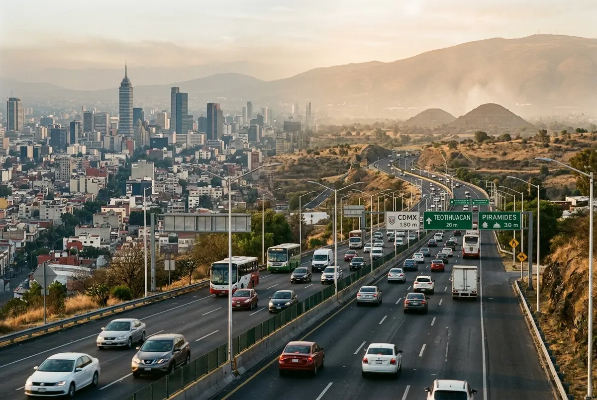
Nearly the entire trip runs along Mexico Federal Highway 132D, a modern, well-maintained toll road connecting Mexico City’s northern edge directly to San Juan Teotihuacan. The road itself is straightforward and well signed, so the route is not a meaningful source of delay regardless of which transportation mode you choose.
Tolls on this highway are modest and typically already factored into a private driver’s quoted price or a tour operator’s cost. If you are self-driving, budget a small amount of cash or a toll card for the drive, since not every booth on Mexican toll roads accepts every payment method.
Does Elevation Change Along the Route Affect the Trip?
Mexico City sits above 7,300 feet, and Teotihuacan sits only slightly higher, so there is no significant elevation change along the drive itself to worry about. Both cities share the same high-altitude climate, meaning sun exposure and the thinner air affect your visit once you arrive and start walking, not the travel time getting there.
If you are newly arrived in Mexico City and still adjusting to the altitude, pace yourself on the pyramid climbs once you reach the site rather than during the drive, since the road itself presents no altitude-related challenge.
How Far Is Teotihuacan From Mexico City Airport Specifically?
Travelers flying into Mexico City International Airport are often surprised that the airport sits roughly the same distance from Teotihuacan as central Mexico City does, sometimes closer depending on traffic patterns that day. This is exactly why direct airport transfers exist as their own category of tour rather than requiring a detour into the city first.
Yes, the short distance is exactly why a half-day tour, rather than a full day, is the standard format most operators offer. Between the roughly one-hour drive each way and two to three hours exploring the main pyramids, a half-day trip comfortably covers the core experience without eating into an entire vacation day.
Full-day and combo formats exist for travelers who want to add a second stop, not because the distance itself demands more time. If your priority is simply seeing Teotihuacan efficiently, a half-day tour is the format built around this exact travel time.
Why Do Map Apps Sometimes Show a Different Travel Time Than One Hour?
Navigation apps calculate a live estimate based on current traffic conditions at the exact moment you check, so the number on your phone can swing higher or lower than the general one-hour figure quoted throughout this guide. A late-night search often shows 45 minutes, while the same route checked during morning rush hour can show well over 90 minutes for the same roughly 50 kilometer distance.
Treat a map app’s live estimate as the more accurate figure for your specific departure time, and treat the one-hour baseline in this guide as the number to plan around when you are booking a tour or setting an alarm days in advance, before real-time traffic data is even relevant yet.
Frequently Asked Questions
How many kilometers is it from Mexico City to Teotihuacan?
About 50 kilometers, or roughly 31 miles, from central Mexico City to the archaeological zone.
Is Teotihuacan a day trip from Mexico City?
Yes, Teotihuacan is a classic half-day or full-day trip from Mexico City, with most visitors returning to the city the same afternoon or evening.
Does the distance change depending on which part of Mexico City I start from?
Slightly. Starting from a northern neighborhood shaves a little time off the drive, while starting from the far south adds some, though the difference is usually modest compared to traffic conditions.
Is an hour the same for the bus and a private car?
Roughly, yes. Both travel the same highway route at similar speeds, so the real difference between them is convenience and cost, not travel time.
Ready to visit?
Book your tickets in advance: popular time slots sell out.